Old Beechy Rail Trail
Warning
CURRENT TRAIL CLOSURES
THE OLD BEECHY RAIL TRAIL IS CLOSED BETWEEN BANOOL & BEECH FOREST UNTIL FURTHER NOTICE DUE TO LOGGING OPERATIONS.
USERS OF THE TRAIL ARE ASKED TO OBEY ALL SIGNAGE DISPLAYED ALONG THE TRAIL AND NOT ENTER AREAS WHICH HAVE SIGNAGE INDICATING A TRAIL CLOSURE.
The Old Beechy Rail Trail is OPEN from Colac to Banool (south of Gellibrand), and Beech Forest to Ferguson.
PLEASE NOTE: The Old Beechy Rail Trail passess through both public and private land. Users of the trail are asked to respect the private landowners rights to use their land, with many private property sections of the trail being used on a daily basis for farming activities. Cyclists are asked to reduce their speed whilst travelling through the private property sections of the Old Beechy Rail Trail.
OLD BEECHY RAIL TRAIL CLOSURES DUE TO LOGGING OPERATIONS
-
The Old Beechy Rail Trail is currently CLOSED between Banool (south of Gellibrand) and Beech Forest. This trail closure is in place until further notice due to logging operations.
-
USERS OF THE TRAIL ARE ASKED TO OBEY ALL SIGNAGE DISPLAYED ALONG THE TRAIL
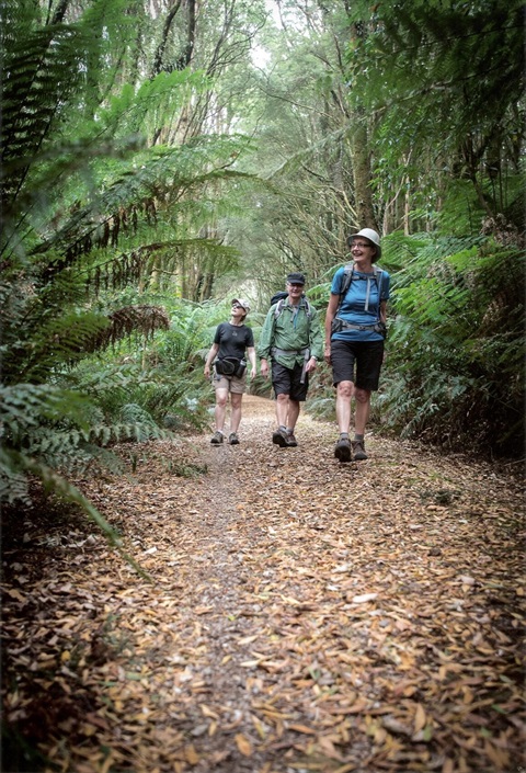
The Old Beechy Rail Trail follows one of the state’s former narrow gauge railways through an area of scenic forest, rich farmland and rolling hills with the coast not too far away. There is excellent bird life and rainforest pockets, see magnificent eucalypts and blackwoods shading the lush understorey.
The Old Beechy Rail Trail is a 50km walking/cycling trail, located between Colac and Ferguson, situated two hours west of Melbourne. The trail follows much of the original path of the narrow gauge railway “The Beechy” which ran from 1902 until 1962.
The development of the Trail was the culmination of sixteen years work by the Old Beechy Rail Trail Committee which formed in 1998, bringing together interested groups from Colac, Gellibrand, Beech Forest and Lavers Hill, to make the trail a reality.
The 2'6" narrow gauge line was opened to Beech Forest in 1902 and was extended to Crowes in 1911. By 1940, only one trip a week was being made, and by 1954 the terminus of the line had shifted back from Crowes to Weeaproinah. The line was closed in June 1962 despite strong objections from many local people. Many sawmills built tramways in the forest and sidings on the Beechy line and the remains of some can still be seen. The line ran 'mixed' trains with passengers and goods (timber, cattle, potatoes, cheese and other farm produce).
The steam locomotives travelled at a maximum speed of 20 miles an hour between Colac and Gellibrand and 10 to 15 miles an hour on other sections. Parts of the railway were sold when the line was closed. The rail trail committee has done an amazing job negotiating with land owners to allow so much of the trail to follow the original route.
Don’t feel up to walking 50km? The Old Beechy Rail Trail can be walked in sections, refer to the attached brochure or see below for more information.
View or print a map from the attachment of the trail or see information of the trail.
Riding the trail. When planning for this trail, you should note that the trail is almost continually downhill from Beech Forest to Gellibrand and it is best suited for mountain bikes. There is a small section between Ditchley and Dinmont which is unsuitable for cycling.
Access to the trail is free and is suitable for walking and bicycles (mountain bikes).
Please note - for some sections of the trail there is limited mobile phone coverage.
Preview
Old Beechy Rail Trail Video
Fast Facts
Where The trail runs between Colac and Ferguson, two hours west of Melbourne.
Distance 50km trail, which can also be completed in short sections and in either direction.
Gradient Some gentle slopes and undulating trail to steep up and down hill sections.
Surface Large sections of purpose-built trail with compacted gravel, short sections of heavy gravel on dirt roads and some sealed roads.
Suitability Trail suitable for mountain bikes and walkers (dogs are allowed on a leash). Some sections of the trail suitable for beginners and families, some only suitable for intermediate to advanced riders. The attached brochure provides more detail or see the “Trail Information – Sections” section of the page.
Gates Timber chicanes are found along the trail, which may restrict bikes with trailers or three-wheelers. Keys can be arranged through Colac Otway Shire, phone 5232 9400 during business hours.
Signs Signs are provided right along the trail, but keep your eye out, particularly for directions on and off the gravel road sections. The trail features outstanding and innovative interpretative signs along the route.
Trail Information - Sections
- THE OLD BEECHY RAIL TRAIL IS CURRENTLY OPEN FROM COLAC TO BANOOL (SOUTH OF GELLIBRAND), AND BEECH FOREST TO FERGUSON.
- THE TRAIL IS CLOSED BETWEEN BANOOL (SOUTH OF GELLIBRAND) TO BEECH FOREST DUE TO LOGGING OPERATIONS - USERS ARE NOT ABLE TO ACCESS THE TRAIL IN THIS SECTION.
SIGNAGE HAS BEEN INSTALLED AT BANOOL INFORMING USERS THAT THE TRAIL IS CLOSED AHEAD. TRAIL USERS MUST OBEY ALL INSTALLED SIGNAGE AND NOT ENTER SECTION OF THE TRAIL WHICH HAVE BEEN CLOSED.
- THE OLD BEECHY RAIL TRAIL PASSES THROUGH BOTH PUBLIC AND PRIVATE LAND. USERS OF THE TRAIL ARE ASKED TO RESPECT THE PRIVATE LANDOWNER RIGHTS TO USE THEIR LAND. MANY PRIVATE LANDOWNERS USE THEIR PROPERTY ON A DAILY BASIS FOR FARMING ACTIVITIES. CYCLISTS ARE ASKED TO REDUCE THEIR SPEED WHILST TRAVELLING THROUGH THE PRIVATE PROPERTY SECTIONS OF THE OLD BEECHY RAIL TRAIL.
If you don’t want to complete the trail all at once, the Trail can be completed in sections (see the section descriptions detailed below for more information).
- Colac - trail information shelter at Colac railway station
- Barongarook - turn east on Barongarook Rd from the Colac-Lavers Hill Rd. Parking is available at the local hall.
- Birnam - turn east on Cashins Rd from the Colac - Lavers Hill Rd and follow it 1km to the picnic ground (old Birnam staion). The trail is signposted here.
- Gellibrand - park at the information centre. The trail is signposted at each end of town.
Old Beechy Rail Trail Closure between Banool (south of Gellibrand) and Beech Forest
Users of the Old Beechy Rail Trail are advised that the trail is CLOSED between Banool and Beech Forest due to logging operations. It is not recommended that users of the Trail use Old Beech Forest Road due to the number of vehicles using this road including logging vehicles.
- Dinmont - on the Old Beech Forest Rd.
Old Beechy Rail Trail Closure between Dinmont and Ditchley
Users of the Old Beechy Rail Trail are advised that the trail is CLOSED between Dinmont and Ditchley.
Walkers and cyclists could use Old Beech Forest Road, however this is not advised due to the number of vehicles using this road including logging vehicles. If walkers and cyclists do use Old Beech Forest Road they are advised to take care and watch for logging vehicles, observe all warning signage and other traffic control instructions in place.
- Beech Forest - The trail to Gellibrand/Colac begins on the western edge of town south of the information shelter.
- The trail to Ferguson begins on the southern side of the Beech Forest - Lavers Rd, east of the information shelter
- Ferguson - the trail begins next to the Otway Nourished cafe in Ferguson
Section Descriptions
Colac – Barongarook (11km)
This section of the trail is entirely on-road since the original railway route is no longer available. Less experienced cyclists may prefer to start at Barongarook. Sections are steep, with loose gravel.
- From the Colac railway station, cross the foot bridge over the railway and follow the signposted route out of town via Wilson St, Queen St, Aireys St, Woodrowvale Rd and Forest St.
- Follow Forest St for 4km to the end. Turn left into Barongarook Rd. Follow Barongarook Rd for 2.3km.
- Turn right at Alford Rd. After 1km, turn left at Maggios Rd. After 500m, the rail trail starts on the right.
Barongarook – Birnam (6km)
The trail travels through bushland to Cashins Road, and is particulatlry beautiful. The trail surface is very good.
Birnam – Kawarren (3.5km)
The trail leaves the original railway formation in this section and has a very steep climb and descent on a gravel surface.
- Turn right at Cashins Rd. The trail starts again on the left hand side.
- The trail climbs steeply through bushland and then descends again, entering farmland.
- The trail rejoins the railway alignment at the site of Kawarren station.
Kawarren – Gellibrand (6.5km)
- Follow the trail as it runs beside the main road.
- Just before Gellibrand, cross the main road. A pedestrian and cycle bridge has been built to carry the trail over the Gellibrand River. The original railway bridge was demolished to make way for the current road.
- The original railway station building survives at Gellibrand and contains an historical display.
Gellibrand – Dinmont (13.9km)
A section of this part of the trail is CLOSED from Banool to Beech Forest due to logging operations. Signage has been installed to inform users that the TRAIL is CLOSED AHEAD. For trail user safety, trail users must obey all signage and not enter sections of the trail which have been closed.
The trail from Gellibrand to Beech Forest is steep and rough in parts. Not suitable for inexperienced riders.
- The trail shares the footpath through Gellibrand. Cross the road again at the southern edge of town to rejoin the original railway formation.
- Entering farmland, the trail starts the climb to Beech Forest.
- There is one short on-road section. Watch for log trucks on this gravel road.
- At Dinmont, the old railway water tank is still in use.
Dinmont – Beech Forest (4.5km)
TRAIL CLOSURE BETWEEN DINMONT AND DITCHLEY IS IN PLACE
- Users of the Old Beechy Rail Trail are advised that the TRAIL IS CLOSED BETWEEN DINMONT AND DITCHLEY. Walkers and cyclists could use the Old Beech Forest Road. Walkers and cyclists are advised to take care and watch for logging vehicles, and observe all warning signage and other traffic control instructions in place.
- A new off road section has been built from Dinmont to Ditchley - PLEASE NOTE: THIS SECTION OF THE TRAIL IS CURRENTLY CLOSED. Sections of this new trail near Ditchley are steep and you will need to walk your bike in sections (please follow and obey all signage). Follow the original alignment until reaching farmland. Travel beside farmland on created trail. Enter the picturesque but challenging section of the trail within the gully beside the Little Lardner Creek. This section can become very challenging within the gully areas. Alternatively, some cyclists may ride the on-road section between Dinmont and Ditchley.
- From Ditchley to Dinmont, the trail is off-road and is suitable only for advanced riders/walkers for the uphill sections of the trail. THIS SECTION OF THE TRAIL IS CURRENTLY CLOSED.
- At Beech Forest look for the site of the balloon loop (used for reversing trains) at the eastern end of town.
Beech Forest – Ferguson (4km)
- This new section was formally opened in March 2015.
- The 4km trail begins on the southern side of the Beech Forest-Lavers Rd, east of the information shelter at Beech Forest. Follow it west through a beautiful dense canopy of rainforest and ferns. It then traverses farmland close to the road, until it reaches Ferguson, which has a rustic and relaxing cafe.
Location
Starts outside the Colac Railway Station, Gellibrand Street and ends at Ferguson in the Otways., Beech ForestColacFergusonGellibrandKawarren 3250 View Map
-38.3382688,143.5869124
Starts outside the Colac Railway Station, Gellibrand Street and ends at Ferguson in the Otways. ,
Beech ForestColacFergusonGellibrandKawarren 3250
Starts outside the Colac Railway Station, Gellibrand Street and ends at Ferguson in the Otways. ,
Beech ForestColacFergusonGellibrandKawarren 3250
Old Beechy Rail Trail
Photo Gallery